
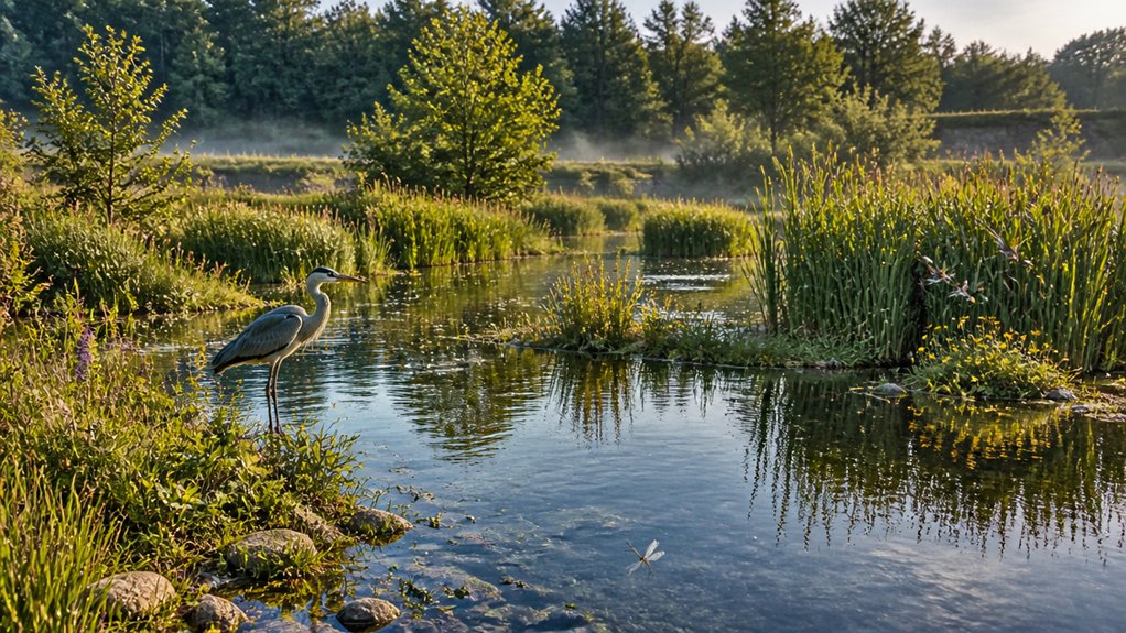
Former sand and gravel pits across the UK can become thriving wetlands because deep water, shallow margins and exposed mineral soils create varied habitats, while groundwater can sustain water levels in dry periods. To boost biodiversity, you can shape gently graded banks, add seasonal pools and plant locally sourced native species. Connect ponds and reedbeds to nearby habitats, then monitor wildlife and water quality. Careful management can also store runoff and reduce flood risk; the sections below explain how to plan each step.
Why Gravel Pits Suit Wetland Restoration
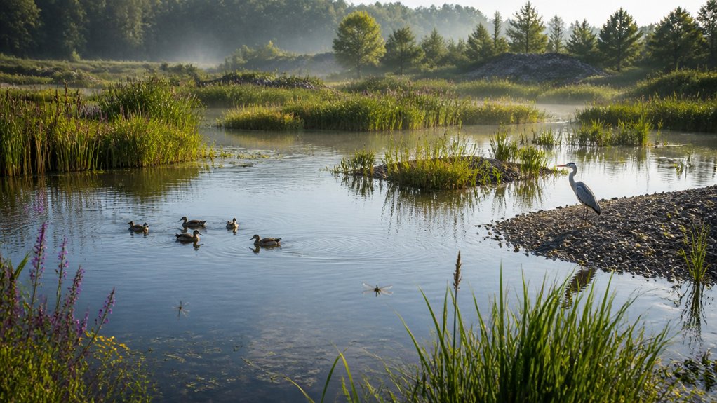
Once extraction ends, a gravel pit’s steep-sided basins, varied depths and exposed mineral soils can provide a useful starting point for wetland restoration. Sand extraction and gravel extraction often leave a mosaic of deep water, shallow margins and bare ground, creating varied conditions for aquatic and terrestrial species.
In the UK, groundwater-fed pits may sustain water levels through dry periods, while surface-water basins can support seasonal wetlands. Their mineral substrates typically contain fewer nutrients than fertile topsoil, which can limit vigorous plant growth and favour specialist wetland vegetation.
You may also find that existing quarry edges, islands and sheltered bays offer nesting, feeding and refuge habitat for birds, amphibians and invertebrates. These features give former pits ecological potential, although outcomes depend on local hydrology, water quality and surrounding habitats.
Plan a Wetland Restoration
Before designing your restoration, assess the site’s hydrology, soils, water quality and existing habitats against UK baseline data.
Use those findings to set measurable objectives and identify constraints such as flood risk, contaminated sediment or protected species.
Then design habitat features—such as shallow margins, varied water depths and native planting—to match local conditions and target species.
Assess Site Conditions
To plan a wetland restoration, first assess how the site’s geology, water levels and existing habitats interact. Map former extraction areas, spoil deposits and remaining soils; these determine infiltration, groundwater movement and substrate stability.
Use Soil testing to measure texture, pH, organic matter and nutrient status, then compare results with the requirements of locally appropriate wetland communities.
Record seasonal water levels and flows, including links to rivers, drains and groundwater, so you can distinguish persistent inundation from temporary flooding.
Check historic land-use records and undertake contaminant assessment where industrial inputs, fuel storage or imported fill may have introduced pollutants.
Survey existing vegetation and wildlife, noting protected species, invasive plants and habitat connections.
Consult the Environment Agency, local records centres and planning authority.
This evidence helps you identify constraints before selecting restoration measures.
Design Habitat Features
With site conditions mapped, translate the evidence into a habitat plan that suits local species and water dynamics. Set shallow shelves and gently graded margins to support emergent plants, wading birds and amphibians; retain deeper pools for overwintering fish and drought refuge.
Use varied water depths, seasonal drawdown and wet grassland to create a habitat mosaic, guided by local records and relevant UK Biodiversity Action Plan priorities.
Place islands or undisturbed banks where ground-nesting birds can breed safely, and keep livestock access controlled to limit erosion and nutrient inputs.
Connect ponds, reedbeds and nearby habitats through Wildlife corridors, such as hedgerows and vegetated ditches, while avoiding barriers to movement.
Add Educational signage at access points to explain sensitive areas and responsible visitor behaviour.
Specify measurable targets, then monitor species and water levels to refine management.
Shape Ponds, Banks, and Shallow Water
Shape ponds with varied depths and profiles to support a wider range of wetland species.
Build gently sloping banks, which give wildlife access to water and allow marginal vegetation to establish.
Create shallow-water zones, as these warm quickly and provide feeding and breeding habitat for UK amphibians, invertebrates, and birds.
Shape Ponds for Variety
A wetland’s shape determines how much habitat it can support. Vary pond depth to create distinct zones: shallow margins warm quickly and support emergent plants, while deeper water offers refuge for fish and amphibians during drought and cold.
Include several connected basins rather than one uniform pool; this increases habitat diversity and allows species to move between feeding and breeding areas.
Shoreline curvature matters, too. Irregular edges, coves and small inlets increase the length of the water–land boundary, creating more opportunities for plants, invertebrates and birds.
In former UK gravel workings, use site surveys to guide basin layout and account for groundwater levels, flood risk and seasonal water changes.
You’ll create a varied, resilient wetland without relying on a single depth or shoreline form.
Build Gentle Banks
As you form pond margins, grade banks gently rather than cutting steep sides. Gentle banks reduce abrupt changes in water depth, helping amphibians, invertebrates and waterbirds reach the water and move between aquatic and terrestrial habitats. They also provide more stable ground for marginal plants, whose roots bind sediment and support erosion control.
Set gradients to suit the site’s soils, water levels and intended management; there’s no single slope for every former quarry. On loose sand or gravel, a steeper profile may slump, so consult a restoration ecologist or geotechnical specialist before fixing the design.
Use locally appropriate, low-nutrient substrates where needed, and avoid compacting the bank excessively. Check edges after heavy rain and seasonal water-level changes, then repair rills or slumping promptly.
These measures help your pond margins remain stable and functional.
Create Shallow Water Zones
Once you’ve graded the banks, create shallow water zones within the ponds to support a wider range of wetland species. Vary depths and contours rather than forming a uniform shelf: submerged margins, gently sloping edges and small, seasonally exposed areas provide distinct habitat zones.
Aim for broad shelves generally less than 30 cm deep, adjusting levels to local soils, water supply and target species. These areas warm quickly, supporting aquatic invertebrates and amphibians, while emergent plants offer cover and feeding sites for birds.
Keep some open water to maintain a varied pond structure, and avoid abrupt drops that can trap wildlife. Check proposed levels against seasonal fluctuations and flood conditions.
Use clean, locally appropriate substrates, and control invasive plants during establishment. Monitor water depth and vegetation after construction, then adapt management as conditions change.
Plant Native Wetland Species
Planting native wetland species helps former sand and gravel sites develop into resilient habitats suited to local conditions. Choose plants matched to water depth, seasonal flooding, soil chemistry and exposure; these factors determine establishment and survival.
Use locally appropriate provenance where available, reducing risks from maladapted stock and supporting regional genetic diversity. Native sedges, rushes and native grasses stabilise exposed margins, trap sediment and provide cover for invertebrates and birds.
In wetter areas, plant wetland trees such as willow and alder, allowing space for mature roots and canopies. Check species against local habitat objectives and avoid invasive non-native plants, which can displace native communities.
Plant in suitable seasons, protect young growth from grazing where needed, and monitor survival. Replace failures selectively, adjusting planting density and species to observed conditions.
Link Wetlands to Nearby Habitats
Native wetland planting delivers greater ecological value when sites connect to nearby rivers, ponds, grasslands and woodlands. You can strengthen these links by retaining hedgerows, reinstating field margins and creating vegetated buffers along ditches and watercourses. Such features form Wildlife corridors, allowing species to move between habitats and supporting dispersal as landscapes change.
In former sand and gravel workings, grade banks gently and connect wet hollows to existing water networks where hydrology permits. This can improve Ecosystem connectivity while reducing abrupt boundaries between restored land and intensively managed areas.
Map neighbouring habitats before you design access routes or drainage, then protect key links during construction and long-term management. In the UK, local nature recovery strategies and ecological network maps can help you identify priorities and coordinate restoration beyond the site boundary.
Attract Birds, Amphibians, and Insects
Design a mosaic of shallow margins, open water and seasonally flooded scrapes to attract wildlife across the site. You’ll provide feeding and breeding niches for different species: wading birds can probe soft sediments, while wildfowl use open water for refuge.
During Bird migration, these habitats can offer stopover resources along UK flyways, especially where you retain undisturbed roosting areas.
Create fish-free ponds with gently sloping edges so amphibians can reach water and their larvae face fewer predators.
Plant native, locally appropriate flowers and maintain sunny, sheltered patches to support bees, hoverflies and other insects.
In turn, insect pollination helps sustain wetland plants and food webs.
Vary water depth and vegetation structure, and leave some bare ground for nesting invertebrates.
Avoid stocking fish, which can reduce amphibian recruitment and aquatic invertebrate abundance.
Monitor Biodiversity as the Site Recovers
As the site recovers, monitor wildlife and habitat conditions at regular intervals to see whether restoration is working. Set a baseline before major changes, then repeat surveys in comparable seasons and weather.
Record species presence and abundance across ponds, reedbeds, grassland and scrub, using consistent methods such as fixed-point bird counts, amphibian surveys and pollinator transects.
Biodiversity indicators should include both target species and habitat structure, so you can detect gains, losses and unexpected shifts.
Map survey locations, effort and results, and retain records in a format your team can compare over time.
Where possible, involve trained ecologists and follow relevant UK guidance, licences and biosecurity measures.
Long term monitoring helps you distinguish lasting recovery from seasonal variation and adapt habitat management when evidence shows particular features aren’t supporting the expected wildlife.
Improve Water Quality and Reduce Flooding
Alongside biodiversity monitoring, assess how restored wetlands affect water quality and flood risk across the catchment. Former sand and gravel workings can provide valuable space to slow, store and treat runoff before it reaches rivers.
Track suspended solids, nutrients and relevant pollutants at inflows and outflows, using consistent sampling to identify seasonal changes and compare results with baseline data. Wetland plants, soils and microbial processes support water filtration, trapping sediment and transforming some nutrients; performance depends on flow, residence time and maintenance.
For flood control, measure water levels and storage during storms, and model how restored basins alter peak flows downstream. UK catchments face heavier rainfall as the climate changes, so assess outcomes across multiple events, not one season.
Coordinate monitoring with the Environment Agency and local flood authorities, and adjust channels or vegetation where evidence shows reduced treatment or storage capacity.
Make Restored Wetlands Welcoming to Visitors
When access is planned around sensitive habitats, restored wetlands can welcome visitors without compromising wildlife. You can guide people along durable paths, raised boardwalks and designated viewing points, keeping footfall away from nesting areas and fragile banks. Seasonal closures and clear boundaries help protect breeding birds, amphibians and wetland vegetation, especially during sensitive periods.
Provide visitor amenities such as accessible routes, seating, cycle parking and discreet waste facilities near entrances, where they’re less likely to disturb wildlife. Educational signage can explain how former extraction pits support flood storage, water quality and biodiversity, while asking visitors to keep dogs under control and avoid feeding birds.
Monitor path erosion, litter and disturbance, then adjust access where evidence shows pressure. Work with local communities and access groups so your design supports inclusive visits and long-term habitat management.